
The science of the Geographe catchment is focusing on monitoring water quality of catchment waterways to monitor long term trends and populate the Geographe catchment model and evaluating the effectiveness of nutrient reduction best management practices.
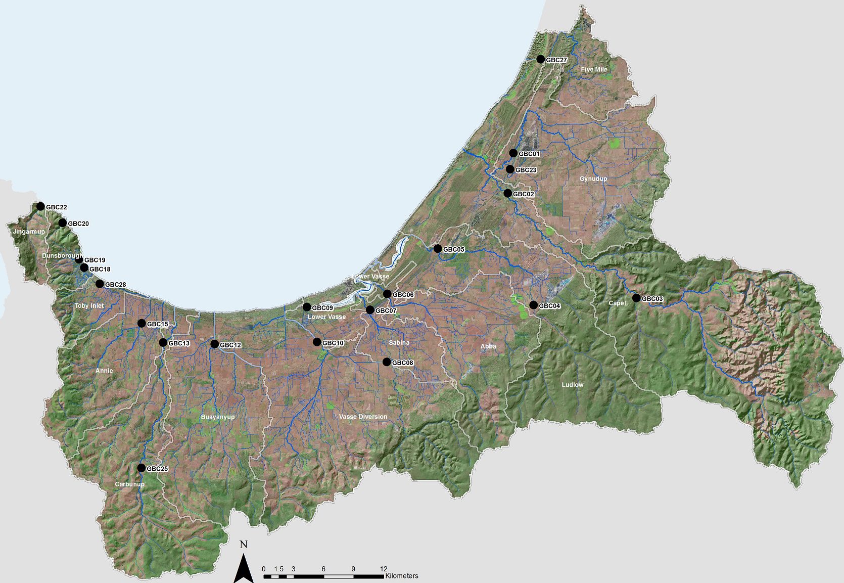
Fortnightly water quality monitoring of the major waterways in the Geographe catchment has been conducted since 2006 by the Department of Water and Environmental Regulation to monitor long term trends in water quality and assess the effectiveness of management actions to improve water quality.
Monitoring of physical parameters and nutrients occurs at 21 sampling sites across the catchment. Water quality data is used to update the Geographe Catchment model and Water Quality Improvement Plan.
Water quality of Geographe waterways ranges from good to poor and is highly variable across the catchment. Waterways that have good water quality and riparian vegetation such as the Carbunup River, retain high social and ecological values. Others, such as the Lower Vasse River suffer poor water quality and are characterised by annual algal blooms.
A summary of the water quality trends of individual Geographe waterways can be found under Geographe waterways. Water Quality Data is also available on the Department of Water and Environmental Regulation website.

The Geographe Catchment model is being updated by the Department of Water and Environmental Regulation to identify sources of nutrients from the catchment and predict the best management actions to reduce nutrients.
The detailed numerical catchment model includes land use, land use practices, soil type, hydrology (rainfall and flow), and nutrient transport pathways. The modelling platform allows identification of nutrient sources by land use and by sub catchment and enables testing of best management practices in reducing nutrient losses from the catchment.
The Catchment model will be used to guide the update of the Vasse-Wonnerup Geographe Bay Water Quality Improvement Plan 2010.
The Soil Amendment trials aim to assess the effectiveness of using the soil amendment, Iron Man Gypsum to reduce phosphorus loss off high nutrient land use sites. Soil amendments are products that bind with phosphorus, keeping it within the soil available for plant growth rather than washing into waterways.
This trial is using the soil amendment Iron Man Gypsum (IMG), a by-product of the Iluka Mineral Sands mine in Capel. IMG is a soft brown loamy material with very high phosphorus retention capacity. It is made up 85% gypsum and 12% iron oxides, with the balance manganese minerals and has been extensively trialled on turf farms on the Swan Coastal plain.
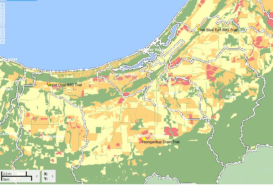
Four soil amendment trial sites are established on sites with a high risk of nutrient loss in the Geographe Catchment.
The City of Busselton has partnered with the Department of Water and Environmental Regulation and Iluka Resources to trial the use of the Iron Man Gypsum (IMG) soil amendment beneath the new oval at the Vasse sporting complex. View map. The IMG has been incorporated into the subsoil using a rotary hoe. The sandy soils at the oval site have a high phosphorous content due to past grazing and horticulture, making the oval ideal for a large scale trial.
The Water Corporation is a partner for the second trial, located at a rural drain that receives high nutrient loads from surrounding land use. View map
A third trial has been established at a Geographe Turf farm. This trial will assess the effectiveness of using top dressing applications of IMG on established turf. The overall aim of these trials is to examine how this soil amendment can be used on the land uses within the Geographe Catchment so that assessment effective implementation can occur once it is commercially available. The Department of Water and Environmental Regulation is carrying out intensive monitoring of all trial sites using lysimeters (pans under the surface that collect water samples); surface water collection and sampling from the sub-surface drainage system.
 pile waiting to be spread")


 being installed under layers of soil and IMG")
