
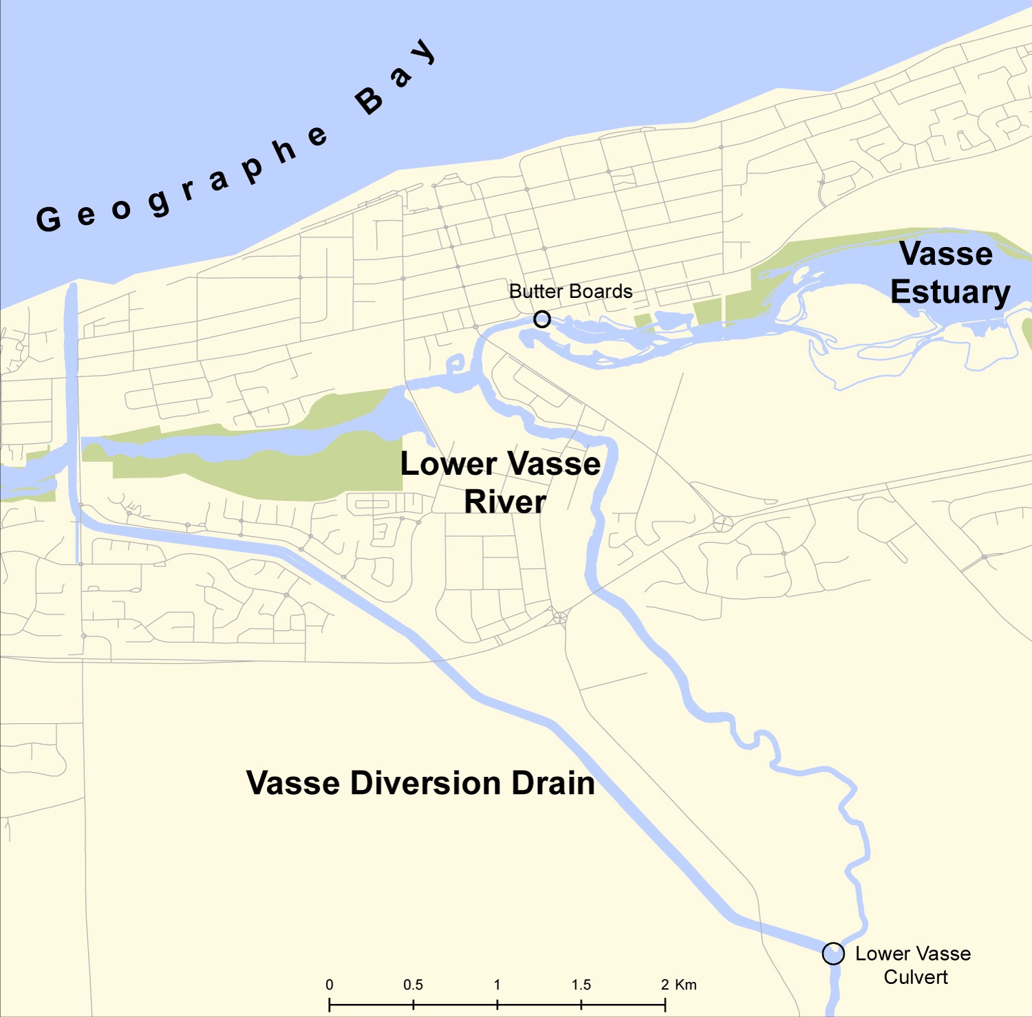
The Lower Vasse River flows through the centre of Busselton into the internationally significant Vasse-Wonnerup Wetland System. The river is highly valued by the local community and has historically been an iconic feature of the town and focal point for recreational and social events.
Improving the visual amenity and water quality of the Lower Vasse River is a priority for the wider community and the Revitalising Geographe Waterways program. The City of Busselton is leading initiatives to improve water quality, health and management of the Lower Vasse River.
The Lower Vasse River is an ephemeral river (only flowing in winter months). The summer months bring high water temperatures, low flows and high nutrient concentrations in the river causing algal blooms and nuisance odours over the peak tourism season.
Despite suffering water quality problems in summer months, a 2018 river health assessment of the Lower Vasse showed that the river has significant ecological value, including a high diversity of native fish and crayfish, with a low abundance of exotic species.
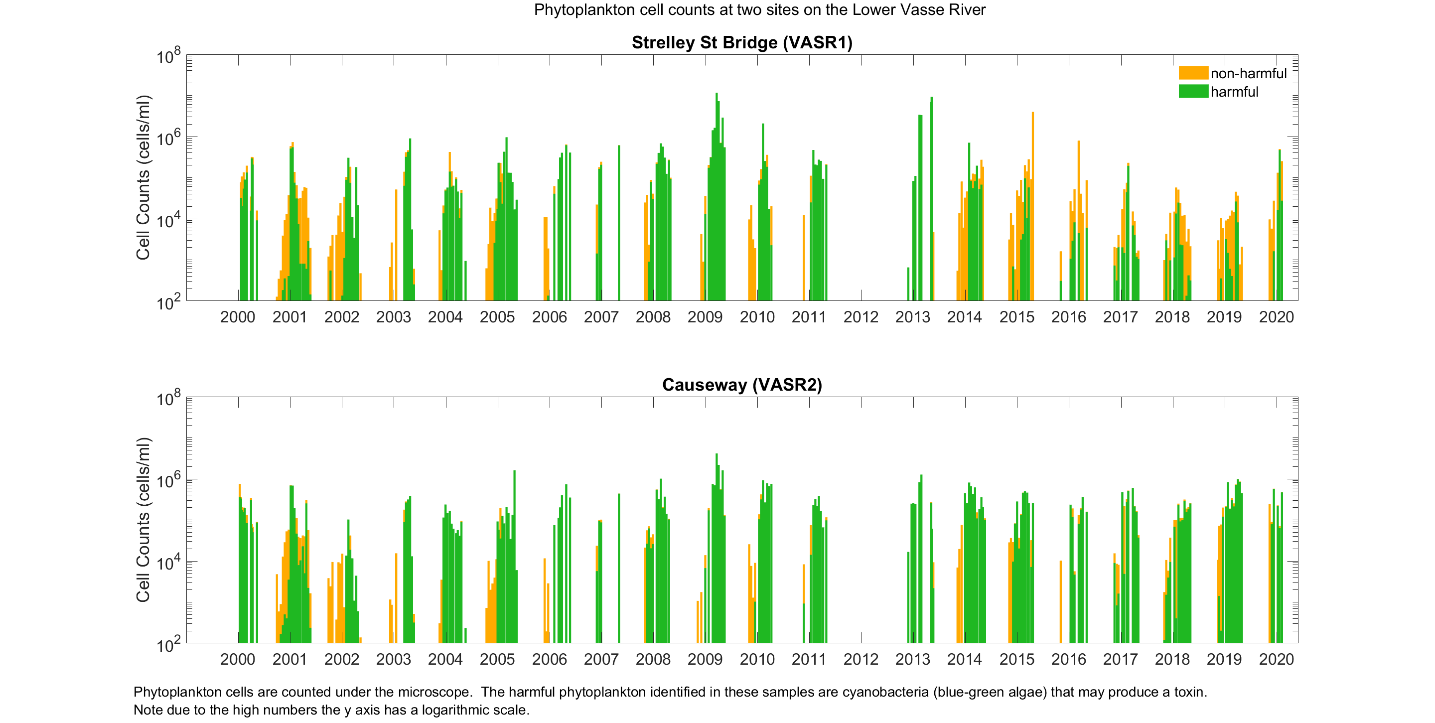
Monitoring since 2000 by the Department of Water and Environmental Regulation shows that water quality and phytoplankton levels have remained stable for the last 20 years, despite increasing pressure from urban development and intensification of agriculture (see graph below).
The poor water quality of the Lower Vasse River, and community concern, has led to a number of major initiatives over the past two decades including the formation of the Geographe Catchment Council (GeoCatch) in 1997.
Lower Vasse River Cleanup Program
Between 1997 and 2007 GeoCatch, the City of Busselton and the (then) Water and Rivers Commission partnered on a number of projects to improve the ecological health of the Lower Vasse River. Projects included a large amount of on ground activity such as bank reshaping and revegetation, dredging and oxygenation trials, a Phoslock (phosphorus binding clay) trial and other activities. The 2005 Lower Vasse River Cleanup Program Review outlines the achievements and recommendations of the program.
The focus of work on the Lower Vasse River began to shift in 2008 when monitoring and modelling for the development of the water quality improvement plan (WQIP) showed that high levels of nutrients were entering the Lower Vasse River from surrounding urban and rural sources, and the river would continue to experience poor water quality in summer unless this was addressed.
Implementing the water quality improvement plan
Between 2008 and 2014, GeoCatch, the Department of Water and Environmental Regulation and partners shifted their focus in line with recommendations made in the water quality improvement plan (WQIP) for the Vasse Wonnerup wetlands and Geographe Bay. Work expanded to the surrounding catchment to reduce nutrients entering the Lower Vasse River. Projects included reducing nutrients from urban gardens through the Bay OK program, reducing nutrients from urban areas through stormwater upgrades, and reducing nutrients from the rural catchment through riparian fencing, best practice fertiliser management and dairy effluent upgrades.
Revitalising Geographe Waterways
Following a mass fish kill in the Vasse Estuary in 2013, the state government commissioned a review into the management of Geographe waterways, and funding followed to implement some of the recommendations. RGW has continued work in the Lower Vasse River catchment to reduce nutrients entering from urban and rural areas. The program has also expanded its focus to investigate ways to fast-track water quality improvements in the river.
Initiating major actions to reduce nutrients entering the Lower Vasse River from both rural and urban sources to improve water quality has been a key aim of the Revitalising Geographe Waterways program.
New science has been used to assess options for increasing flows using the purposely developed Reconnecting Rivers model, and a second culvert from the Vasse Diversion drain to the Lower Vasse River was installed in 2021 to double the flows to the river.
Water treatment trials have been carried out to assess the effectiveness of phosphorous binding clays to reduce algal blooms and determine the volume, composition and options of removal of sediments through a sediment investigation. The Department of Water and Environmental Regulation are undertaking a Phoslock® trial application in the Lower Vasse River between November 2023 and January 2024 to help determine if the product can reduce algal blooms in the river and potentially become a future management option.
Knowledge gained from new science has been used to develop a Waterway Management Plan for the Lower Vasse River. The City of Busselton led the development of the plan that identified long-term management actions to improve water quality and health of the River. The first action to be implemented was the removal of sediment between the Butter Factory Museum and the Causeway Road Bridge in 2022. Further stages of sediment removal have now been scheduled.
The local community was widely involved in the development of the Management Plan for the Lower Vasse River to ensure community ownership of the final plan. The Vasse Wonnerup wetlands Collaboration, made up of community members, scientists and waterways managers, developed management objectives for the Lower Vasse River, which were presented to the broader community for input. Implementation of the plan is led by the City of Busselton.
